By RNZ Pacific
There has been no communication early today from the Vanuatu islands hardest hit by the powerful Tropical Cyclone Harold.
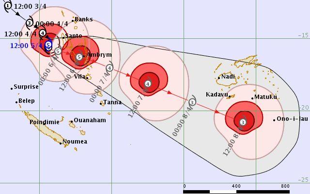
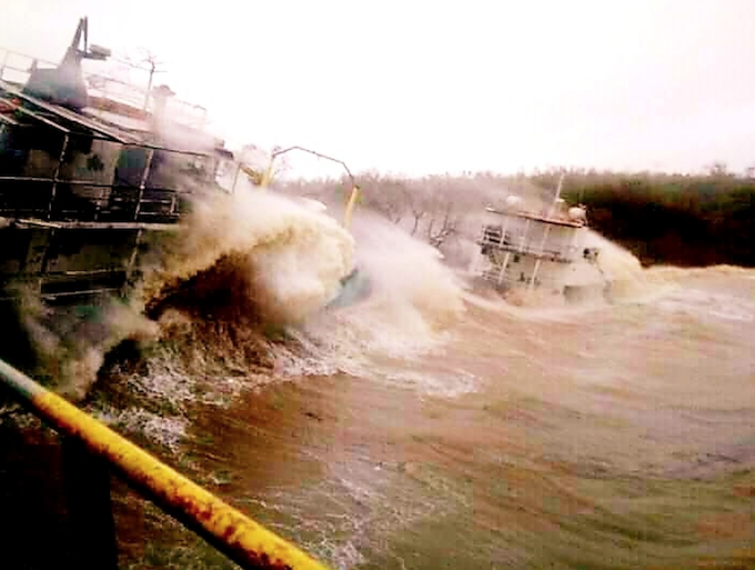
The category 5 storm made landfall on the Vanuatu island of Santo yesterday with destructive winds as high as 235km/h.
The cyclone passed directly over Santo and hundreds of people are sheltering in evacuation centres.
In Luganville, a town of 16,000 people, roofs were blown off houses, trees snapped, and the council building has been destroyed.
Overnight, Tropical Cyclone Harold showed no sign of weakening as it moved across Vanuatu.
One telecommunications provider, Vodafone, said there was a general network outage in Banks, Santo, Malekula and Pentecost.
In a special dispatch last night, RNZ Pacific’s Jamie Tahana reported that Cyclone Harold had made landfall on Santo, with winds gusting as high as 235km/h.
Gathering strength
Cyclone Harold – a category five, the highest possible – had sat just to the west of Vanuatu’s central islands for much of the past day, gathering significant strength in the past 12 hours.
Yesterday afternoon, just after 1pm, local time, the storm made landfall on Santo’s southwestern coast, and is forecast to continue on a track that takes it very close to Luganville, the country’s second-largest town with a population of more than 16,000 people.
Fred Jockley, a managing forecaster at the Vanuatu Meteorological Service, said this storm was the most serious since Cyclone Pam, which destroyed much of the country in 2015, killing few people, but setting livelihoods, infrastructure and the economy back years.
Jockley said Harold was displaying the signs no one wanted to see: it had effectively stalled, moving as slow as two knots, which allows it to suck up moisture from the warm ocean and gain ferocity; it was growing in size, and its force would likely envelop much of Santo and Malekula, Vanuatu’s two largest islands; and its current track had it skirting very close to Luganville, the country’s second-largest city with more than 16,000 people.
“It’s very slow now. It’s been very slow the past six hours, but now it’s beginning to pick up speed,” Jockley told RNZ Pacific. “It’s going to go through Santo and Malekula.”
“The winds range is covering the whole of Santo and part of northern Malekula.”
Hundreds seek shelter
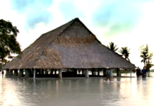
Hundreds of people across Santo had already sought shelter in evacuation centres, and flooding has been reported in many areas. On Monday morning, authorities evacuated people from remote areas where rivers had burst their banks into villages. Communication has since been lost with areas outside Luganville.
The official number of people in evacuation centres is so far unknown.
“We’re expecting more rainfall and flooding to continue over Luganville and Malekula, even extending to Penama and Torba,” Jockley said.
Cyclone Harold comes at the worst possible time for Vanuatu. The country was under a state of emergency because of the Covid-19 pandemic, with the country’s borders sealed, and mass gatherings of more than a few people banned.
